It’s no secret that wildfires are getting worse in the West. They’re threatening lives, homes and ecosystems. And they are also threatening our already-precarious watersheds. It’s all becoming a vicious cycle — especially for the drier parts of our region.
Jonathan Bruno knows this — that fire and water are two forces of nature that are intimately connected in the Western landscape. He’s a wildland firefighter and a conservationist who works for a Colorado nonprofit that protects one of the state’s largest watersheds.
He took me to a steep canyon at the edge of Colorado Springs to show me a structure that illustrates the impact fire can have on water flow. It’s a giant metal mesh fence spanning the width of a man-made rock canal.

Bruno described it as looking “like a colander for your spaghetti or something.”
He said these glorified spaghetti strainers cost millions of dollars each. But they serve the important role of catching large chunks of debris that wash down off these cliffs in the mega rainstorms that often come after a big wildfire.
“We're talking about black water full of rocks, full of trees,” said Bruno. “We have seen boulders the size of cars moved after a post-wildfire.”
It’s common knowledge that massive floods after wildfires can sometimes do more damage than the flames themselves. They can wash debris, ash, and sometimes even heavy metals into the water.
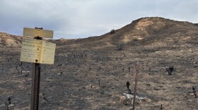
And Bruno has seen it happen. Catastrophic flooding happened right here seven years ago after a massive blaze from the infamous Waldo Canyon fire swept through this and 18,000 acres, near Colorado Springs.

But something most people don’t know is the burn scars from fires actually attract future storms.
“It's because of the amount of heat that's coming off the earth that's drawing these thunder heads in,” Bruno explained.
And these massive burn scars can do something else —speed up snow melt. Eco-hydrologist, Kelly Gleason, recently published a study about that.
“What we found,” said Gleason, “was that for 850 fires which occurred all across the West — snow disappeared about five days earlier on average.”
And in some cases it melted as much as a month early. That’s partly because the vegetation that had shaded the ground was burned off, but that’s not the only reason, according to Gleason.
“There's still this standing dead charred forest,” she said, “which sheds black carbon or soot in addition to kind of chunks of burned charred debris, which concentrates on the surface, darkens it visibly and causes it to absorb a lot more of that available sunlight energy.”
She said it’s like the snow is wearing a black T-shirt on a sunny day. And she found this early melting phenomenon lasts for up to a decade after a fire.
Gleason said this shouldn’t just matter to snow-lovers or people who live at elevation. Because up to 75% of all our water in the West originates as snowpack.
Snowpack is essentially our version of water storage through winter and spring. And if it melts too early, Gleason said, “we really don't have the infrastructure or reservoir storage capacity to hold that water until the summer when we need it the most.”
She said climate change has already made snowpack more vulnerable to early melting. It has also made wildfires larger, more intense and more common. She said together they create a vicious cycle.
Local water providers are also worried about what wildfires can do to water storage and supply.
“That's definitely something that keeps me up at night,” said Mark Shea with Colorado Springs Utilities.
He wasn’t talking hypothetically either. Severe flooding after the devastating Waldo Canyon wildfire here seven years ago did major damage to roads and water pipes. He said it cost millions of dollars and the destruction even got close to impacting water treatment facilities and one of the city’s critical reservoirs.

But he isn’t just sitting around waiting for his worst nightmare to come true. He’s partnered with other agencies that are involved in wildfire suppression — like the U.S. Forest Service.
That’s where Oscar Martinez works. I went with Shea and Martinez up to a forested area above Colorado Springs to see what they’re working on together.
Martinez showed me a recently “treated” stand of ponderosa pine. That basically means his crew had thinned out the trees.
“If you had come here before the treatment,” Martinez said, “it would have been pretty densely packed with individual trees.”
Now they’re far enough apart that there’s some grass and native wildflowers starting to come up from below. The logging remains are stacked into giant pyramids waiting to dry out and be carefully burned off next year.

Martinez said, when conditions are right, they’ll come back and do a prescribed burn here. But even now, if a wildfire comes through, the area won’t burn as hot or as fast and they’ll be able to better predict the path of the flames. And he said that’s the key to how water providers like Shea can better protect their infrastructure.
They’re also working on a plan to include key water elements — like pipelines, treatment facilities and reservoirs — on the maps that firefighters use when they’re actively fighting a wild blaze. So the people on the front lines know how and where to protect the water supply as carefully as they protect homes and lives.
“In Colorado, more than most places,” said Martinez, “our forests and our water pipelines are intimately connected. Eighty to 90% of the water comes off the forest in some way shape or form.”
And doing as much as they can to plan ahead for wildfires, he said, is a way to protect them both.
This story was produced by the Mountain West News Bureau, a collaboration between Wyoming Public Media, Boise State Public Radio in Idaho, KUER in Salt Lake City, KUNR in Nevada and KRCC and KUNC in Colorado.
Copyright 2019 KRCC


